Churdhar (3609 m/ 11850 ft) is the tallest peak of Shivalik Himalaya in Himachal that dominates the skyline and landscape of Sirmour District. Churdhar or Chur-Chandni is a solitary peak that literally means ‘moonlight gleaming on the snow’.
This high point offers a commanding 3600 view; of the far-off mountains of Dhauldhar and Pir-Panjal Himalaya in North, and the gangetic plains in the South. The shimmering lights of Punjab and Haryana on a full-moon light add to the glory of this serene peak.
The mountain edges rush down to the plains from all directions while the evening fog returns home every evening, unfailingly. In between, these falling slopes meet the rising fog and exchange the words of wisdom that are spoken in the ears of the listener waiting for the magic to unfold at the top.
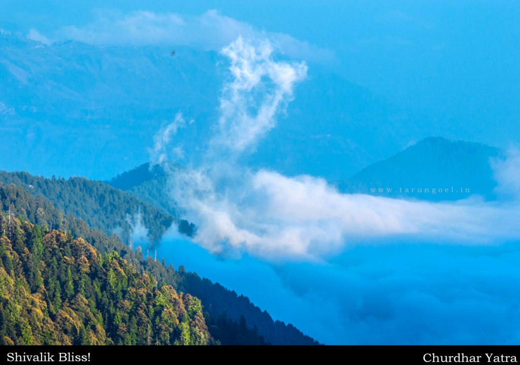
When Skies Meet the Mountains
The British used to call it the Choor and this crown of the lesser Himalaya was quite popular among British climbers. Sir George Everest too climbed Churdhar and this was the highest peak he would ever climb.
The Legend of Srigul
Churdhar is believed to be the abode of Dev Srigul, an incarnation of Shiva, born to Raja Bhokru of Sirmaur. The peak is named after Chur, a servant of Srigul and a devotee of Lord Shiva. When Srigul fought a lone battle against the tyrant Mughals, he handed over his Kingdom to Churu and thus the peak was named after the loyal servant.
Churdhar is also known as Churchandni Peak, which translates to ‘the ridge of the sweeper’.
Today, one half of the temple is located in Shimla District while the other half is in Sirmaur District. Majority of temple priests and management is from Chaupal (Shimla District) and even till date there is an ongoing tussle between these two states regions (erstwhile Sirmur and Jubbal State).
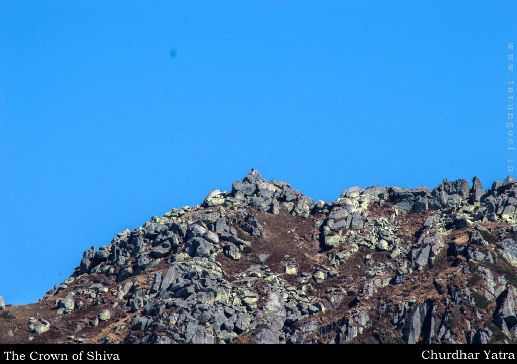
Churdhar Peak
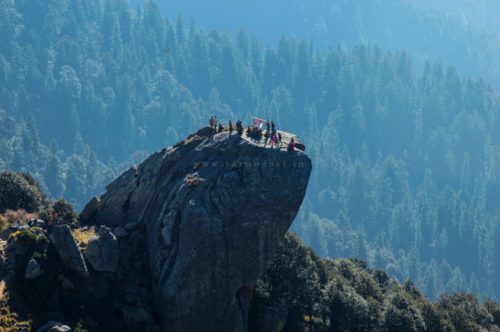
Churu Ka Tibba
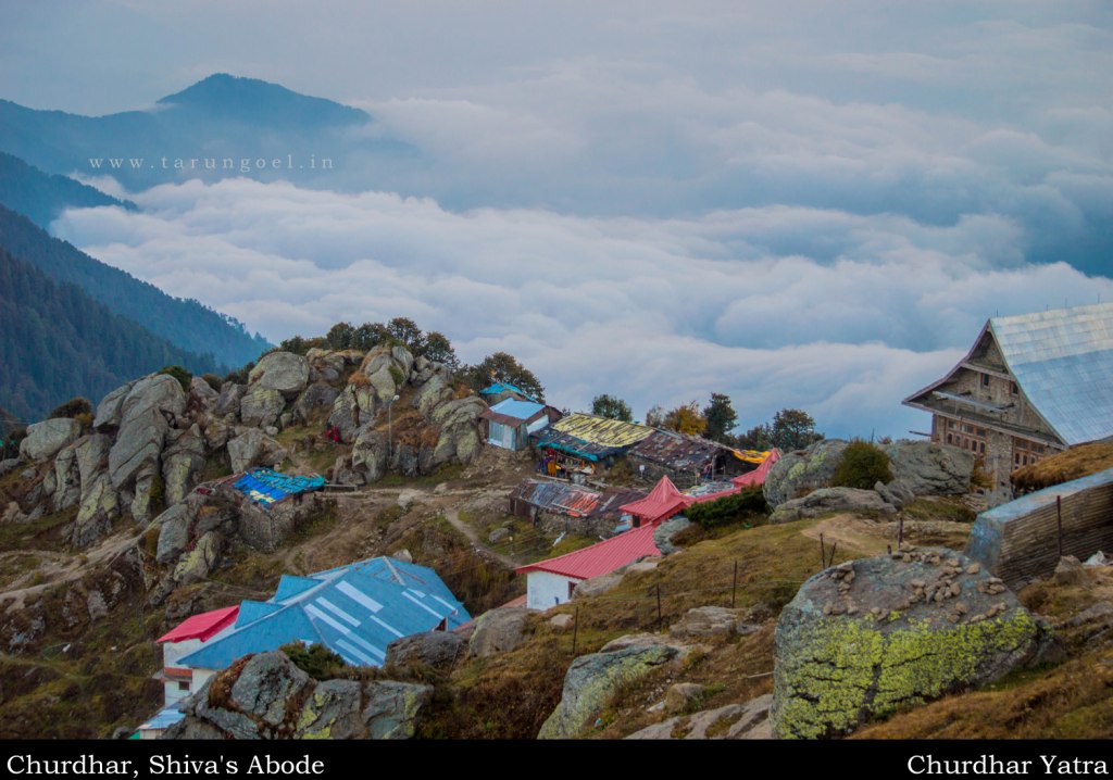
Churdhar Shrine
The main peak lies entirely in the State of Sirmaur and there from one can see the mountains of the Dhauladhar Range along with the prominent peaks of South Parbati Range and Pir Panjal Himalaya.
And for someone like me who has seen very less of the Uttarakhand Himalaya, Churdhar Trek comes out to be an overwhelming experience. Walking in the shadow of the legendary Mount Swargarohini Peak (6252 m) can not be explained in words. The entire Banderpoonch Range spreads wide open in front of you and runs parallel to the infinity.
The great towers of Garwhal Himalaya can be seen from the top and it may will require thorough study and probably a couple of more visits to the Churdhar Peak to understand the nomenclature and orientation of these mountains.
The Trek
There are as many as five approaches to reach Churdhar. The Nohradhar trail being the most rewarding but equally taxing. The trail passes through a thick forest which is said to be the densest forests of the entire state of Himachal. The trail is well marked but exposed to the harsh sun, no matter which part of the year you choose.
Secondly, the latter half of the trail remains hidden from the sunlight throughout the year which makes it an extremely cold region, particularly if you walk across this region in the evening.
Another popular trail is from Chopal village from Shimla. This trail is relatively easy except for the last leg, which is near vertical climb. From Chopal, one has to go to Sarahan which has a majestic Beejat Maharaj Temple, a unique tower temple in the entire region.
The highest point of the trek is 3609 meters and the village of Nohra stands at a height of 2126 meters. The trail is approximately 16 kilometers, excluding them shortcuts which we took, which means a 100 meter gain for every kilometer you walk. This trek can be termed as an easy trek. For the first timers, it is indeed a rewarding walk.
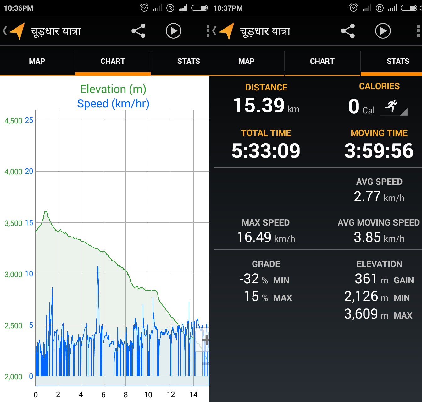
Churdhar Yatra -Nohradhar Trek Map
The highest point on this map is Churdhar Shivling. This map created from top to down, the start point at the top being Churdhar Temple Sarai and the last point being the Nohradhar Bust Stop. The trek map is created with the help of MyTracks Android App.
3600 View Panorama
The zenith of Dhauladhar Himalaya (Hanuman Tibba), the highway to Heavens (Swargarohini), the pride of Pir Panjals (Deo Tibba-Indrasan), and the vast expanse of Garhwal Himalaya, one can actually see all of this from the top of Churdhar Peak.
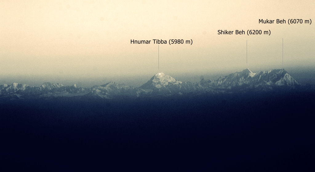
Hanuman Tibba seen from Churdhar
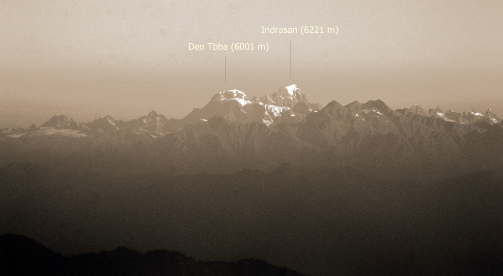
Deo Tibba seen from Churdhar
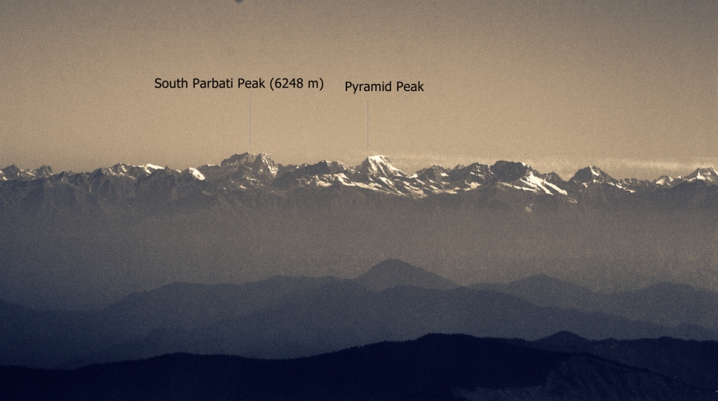
South Parbati and Pyramid Peak seen from Churdhar
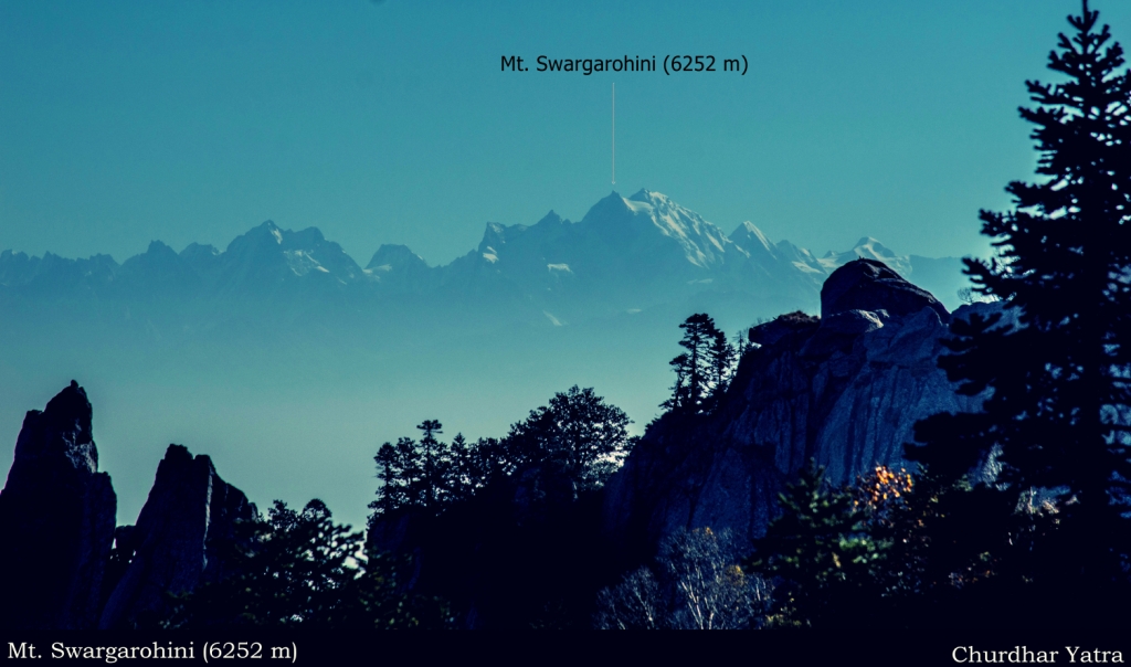
Mt. Swargarohini seen from Churdhar


गज्जब तरुण भाई… आपको इतनी दूर दूर की चोटियों की पहचान कैसे पड जाती है?
Splendid writeup as always. The peak information is a definite plus. I had been waiting for this since I saw the Facebook image.
Thanks Bharat. I’d love to see you go there and click amazing photographs. I am sure you’ll come up with a fresh perspective of these mountains ranges.
नीरज, मैं पहाड़ों को नहीं, पहाड़ मुझे पहचान लेते हैं
good to see the pics of peaks……
as when i went there i wondered which peaks they were…..
चूरधार पर मैने तीन लेख पढ़े।उन लेखों मे मुझे जो चाहिए था नही मिला।लेखक जब किसी प्रसिद्ध धार्मिक चोटी की खुद ट्रेकिंग करके जो लेख लिखता है,उसे अपनी कहानी का रूप दस प्रतिशत और धर्मिक और ऐतिहासिक ज्ञान रूप नब्बे प्रतिशत देने चाहिए।
तरूण गोयल ने भी ऐसे ही रूप मे लेख प्रस्तुत किया है।
यह धार्मिक चोटी जो शिवालक श्रृंखलाऔं मे सबसे ऊंची चोटी है,से हनुमान टीब्बा,देऊ टीब्बा,ईन्द्रासन जो हिमाचल हिमालय के धार्मिक चोटियां है,का दिखाई देना सचमुच चमत्कारिक सा लगता है।उतरांचल की भी धारमिक चोटियां दिखाई देना ,यह और भी आश्चर्यजनक है।
मैं अगले साल इस धारमिक चोटी के दर्शन करूंगा।
I had enjoyed the trip which is memorable . I explained about our trip CHURDHAR YATRA TRECKING to my daughter Nandini which is reading in 9th class in Chandigarh. She is also interested to go to Churdahr.
Thanks for your comment. I am sure your little daughter will enjoy trekking to Churdhar.