This image was shared on Facebook few days back. This image gives a proud feeling to ‘desi travelers’ like me who are unarmed with modern day devices and hi-fi gear.

Source: Internet
However, when you are left only with balls with no money in your pocket and an empty petrol tank, it doesn’t feel that good. We will come to that later.
A small part of Uttarakhand (UK) borders with Himachal (HP) near Rohru and Shillai (Sirmour). Here UK is actually sandwiched between Shimla and Sirmour districts. At places you will see Dehradun or Uttarkashi Tourism welcoming you and suddenly you will find Himachal Tourism asking you to visit again.
Rohru borders with the Uttarakhand state and this was the only (other than Sirmour, which incidentally we finally saw in this trip) motor-able region of Himachal that I hadn’t seen. Road to Rohru via Shimla is a State Highway (SH-10) of International importance because of the Apple Industry. However, this particular stretch of 80KM between Theog and Rohru happens to be the worst road of the state, even worse than the Batal-Chattru stretch in the Lahaul Valley. The road construction contract was awarded to a Chinese Company and just when they were ready to lay bitumen on the surface, the state government backed off.
Now it’s been three long years and the road still stands neglected. I fail to understand the need of awarding a contract to a Chinese company when the likes of C&C (SH-32) and Somdatt Contractors (SH-2) are already doing a wonderful job in Himachal.
Anyhow, by the time we reached Hatkoti we couldn’t recognize ourselves. Clothes, eyes, and beard were all full of dirt and had it not been for the beautiful river view at Hatkoti we would have cancelled the journey. We were not in a condition to take out the camera from the saddle bag and we managed with the mobile camera only.
Pabbar River flows through this region and just a glimpse of this river is a blessing. It makes you forget all your worries and pains. After a tiring and hopeless journey from Theog to Hatkoti , we felt rejuvenated and motivated at the mere sight of Pabbar River.
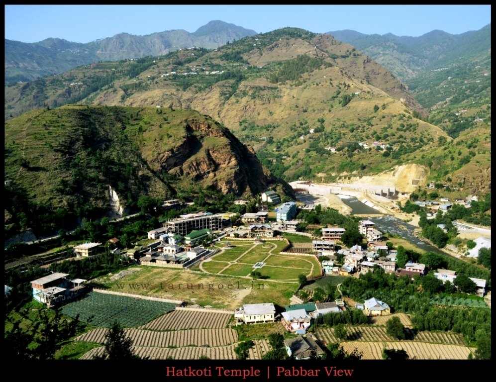
Hatkoti Shrine-Pabbar View, Hatkoti
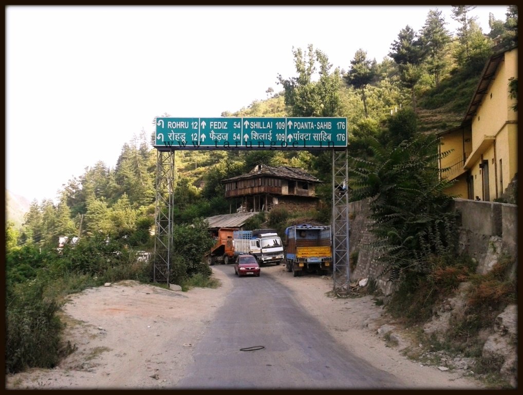
Road to Tiuni, Hatkoti
Pabbar River originates from the Chanshal Ranges while the main stream is fed by the Chandranahan Glacier. Few kilometers downstream, Pabbar merges with the Tons River in Tiuni (UK). Tons is one of the major tributaries of Yamuna River and it originates in Uttarakhand Himalayas from the Banderpoonch mountain ranges.
It is believed that Tons once ran parallel to the Yamuna River and all these rivers were once part of the Great Saraswati River System, which modern historians call the Indus River System. I would recommend reading ‘Sarswati: The Lost River by Michel Danino’. For a quick read please go through this article at Wikipedia.
The road gets better from Hatkoti to Himachal border at Kuddu Village. There is a border check post at Kuddu (8Km from Hatkoti) but it is not the last village of Himachal. Actually it is difficult to tell which village lies in which state. I figured out that (probably) Pandranu is the last village of Himachal Pradesh bordered by UK on both the sides. Tiuni is the first town of UK in this region and its worth spending a night here at Tiuni.
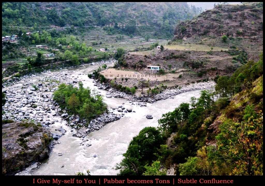
Pabbar-Tons Confluence at Tiuni
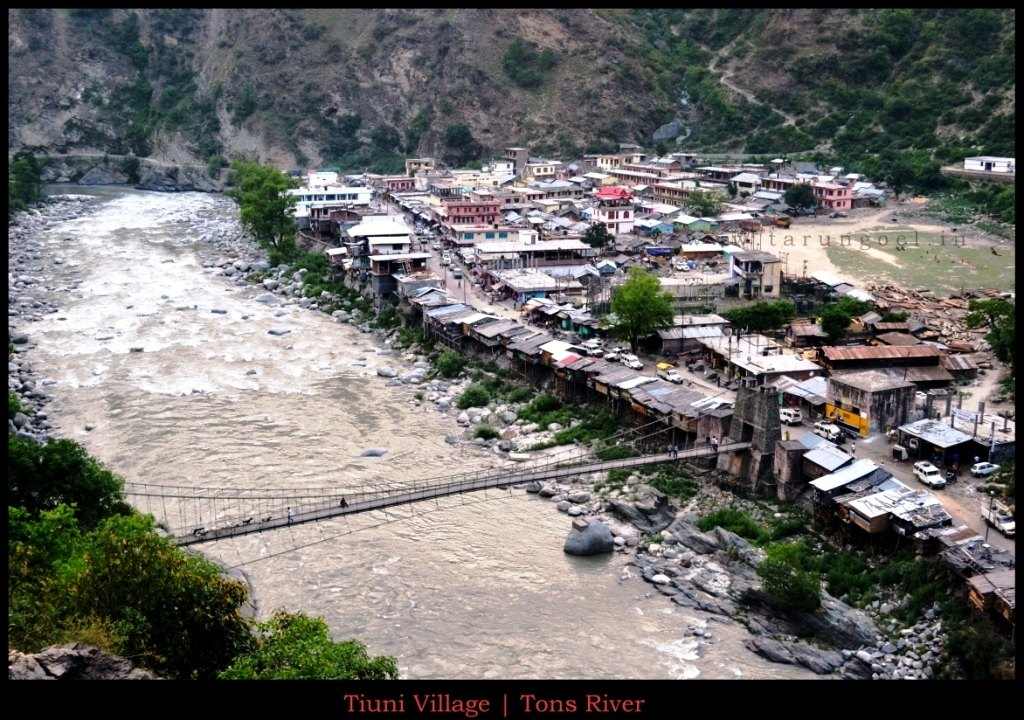
Tiuni Village, Uttarakhand
15 Kilometers upstream river Tons from Tiuni lies the famous temple of revered Mahasu Devta. Mahasu Devta is considered to be the presiding deity of this region. The temple is built in Pagoda style and if you want to spend a night in the wilderness, this is the place for you. Although animal sacrifice is prohibited here after ASI Accreditation but during festival season liquor and meat is all you find. From Mahasu Temple, one trek route takes you to ‘Har Ki Doon’ Valley in Uttarakhand. While Rohru-Hatkoti belongs to the Dhauladhar Himalayas, Sirmour and Shillai belong to the Shivalik Himalayas.
This is one of the most beautiful Pagoda Temples I have seen. River Tons flows close by and the Himalayas make it a perfect camping site. There are three other temples of Mahasu Devta one of which is in the Kullu District.
Mahasu was actually name of the region starting from Shillai to Hatkoti and even outskirts of the main Shimla town were a part of Mahasu Region. Hanol Mahasu was the presiding deity of this whole region before the modern day district-state system stepped in. You can read interesting details about Mahasu Region here (must read).
At Tiuni, Pabbar becomes one with the Tons River silently. This confluence is so subtle that you will not even observe two rivers becoming one. Now from Tiuni, one road leads to the famous Chakrata falls in UK while the other road takes you to the Shillai region of Sirmour District. Even there, Himachal-UK boundaries cross lines and surprisingly UK roads are well maintained and much better than Himachal roads.
The landscape reminds me of Losar Village in Spiti Valley. Roadside terraced farmlands, muddy basin of Tons River, and naked mountains with a hint of greenery resembles Losar pretty much. Fedis Bridge connects Choupal to Sirmour and one can turn towards Shimla from here, which is 145 kilometers from Fedis Bridge. The whole region is so confusing that even I am forgetting which part belonged to which state.
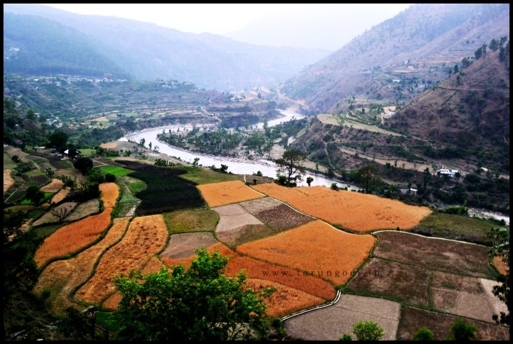
Road to Mahasu Temple, Tiuni
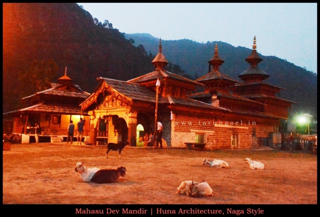
Mahasu Devta Mandir, Tiuni Uttarakhand
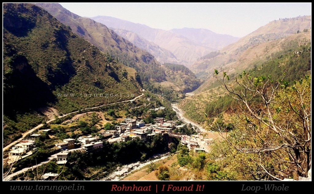
Rohnhaat Sirmour-Shillai
And this reminds of an interesting story. Long ago someone approached my father with a transfer request. His problem was quite unusual. That person couldn’t figure out the location of his new workplace. Surprisingly, even my father didn’t know about that place. And until 23 May, even I wasn’t aware if such place existed in Himachal.
“Goel Sahab, chala to main jaaun par pata to chale ye jagah hai kahan, Maine to naam hi pehli baar suna hai”, said he to my father.
“Maine bhi”, said my father.
The name of that place is ‘Rohnhaat’ which belongs to the Sirmour District of Himachal Pradesh in the Shillai Region. Rohanhat is at the border of Shimla-Sirmour; Kupvi Village being the last village of Shimla on the other side. Kupvi is a village that ends as soon as it begins. There exists one hypothetical road on papers which connects Kupvi to Chaupal Village. However, in reality people have to go Chaupal via Fedis (Uttarakhand).
Shillai is one of the remotest regions of Himachal Pradesh. Not many people in my travel circle have even heard about this place. And even I got to see this region by chance. And before you can notice, Rohnhaat appears out of nowhere.
One will find petrol and ATM at Tiuni and if you are unlucky as we were, you will find neither petrol nor a functioning ATM. By the time we left Tiuni, we were left with balls only. We had 3-4L petrol in our motorcycle, 160 rupees in our pocket. Soon we realized that our balls too will bust because the road to Shilai-HaripurDhar was nothing less than a nightmare.
Now looking at the image I shared in the beginning, I strongly feel that money and petrol is equally important. Just balls won’t do.
Soon we were en-route Shillai with a hope to find an ATM first and a petrol pump after that. Haripurdhar is 30KM from the main State Highway and it is all dirt-track with Chamba like gorges waiting for you with open mouth. HaripurDhar divides the Shillai region from Rajgarh Belt and it is overlooked by ChurDhar, the highest peak of the Shivalik Himalayas.
One can directly go to Solan via Rajgarh from HaripurDhar but this road is believed to be the worst road of the Sirmour District. We couldn’t bust our balls anymore so we decided to take the alternate route via Shri Renuka Ji Lake. This lake is fed by the Giri River originating from the Khara Pathhar near Hatkoti in Shimla District. Pabbar, Tons, Yamuna, and Giri flow through the Sirmour District.
By the time we reached at the top of HaripurDhar, we were out of money and petrol. We could buy petrol at 80/ Liter but at the most we could afford only two liters. The nearest ATM was still 85 Kilometers away.
And then we got a surprise call!
Next: Sangrah (Sirmour) – Har Gaanv Ki Kahani and the Magic Of Himachal State Highways!
Laters!
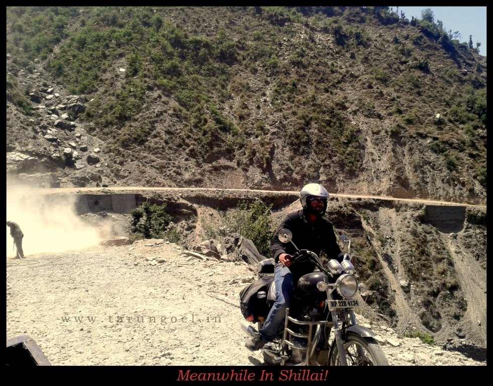
Meanwhile In Shillai!
Best Time to Visit: At the beginning of the rainy season. Rivers are not yet murky and the valley turns green.
Best Route: Shimla to Hatkoti, Hatkoti to Tiuni (Stay) | Tiuni to Chakrata or Tiuni to HaripurDhar
One can hike up the Churdhar Peak (3647 meters) from HaripurDhar, the tallest peak of the Shivalik Ranges.
We stayed at Tiuni at C. Mohan Hotel(9411548954) which was a decent hotel, good enough to spend one night. One can even stay at the Hanol Mahasu Temple but then you will miss drinking beer at the banks of Tons. Surprisingly, one can find Tuborg and Calsberg in Tiuni other than Kingfisher.

Excellent as ever. If I am not mistaken you have written after a long time.
Waiting for P II
Nice one Tarun. Loved reading it.
Riding, traveling and then narration is like liberation…keep moving…
Wow nice story, journey must be memorable but you compose it in words, it is really eagerness to read entire story.
Keep writing kid!
Some people get to experience this Himalayan bliss only through your blogs. (Y)
wonderful post and my village is located near tiuni….we own some shops in Tiuni….feels nice reading it…the name of my village is maneoti and it is the last village in chaupal and lies on border of Himachal and Uttrakhand……great work simply to see my native place covered in through a blogpost
Ava- Thanks. Will update you when I update it.
Negi Bhai Thanks!
Avnish Ji – Thanks. Moving on is little difficult hard but trying.
Arundhati – Thanks!
Pandey Beautiful village Tiuni
Pingback: From Shillai to Heritage Village Sangrah | Magical Himachal Highways « Conversations « LoOp-WhOlE
Aap aaye nahin Beohar ji waapis mud ke
Aate rahiyega hamari taraf. Achha lagta hai
THanks Ava! Tusi mud ke ni aaye?
Pingback: The Court of Ghatotkach – Of Nails & Barbed Wires | Har Gaanv Ki Kahani | LoOp-WhOlE
This is an awesome road full of nature and so many things I love it. Rajesh Kumar
Nice article
Nice yr!!! I hv a strong attachment with tiuni uttrakhand …. Its a vry ntrful place I ever seen
so nice place i love utra khand tiuni